RTK and Laser Scan Survey of Karalee Rock Summary:
One of our employees is currently finishing his last year at Curtin University, Perth in Australia. A two week expedition was undertaken from 2nd July to 19th July in the Northern Goldfields of Leonora. The expedition enables students to gain experience in the outback, work with mentors and to undertake fieldwork related to their final year project. 10 students together with 10 mentors undertook the two week camp where they camped at different remote locations.
One particular project was to undertake an RTK and laser scan survey of Karalee Rock and Dam. This was built in 1890s to service the steam engines that were serving the rapidly growing goldfields region following the 1890s gold rush. The system worked with the water that landed on the 138 acre rock, being guided by a stone retaining wall around to a steel flume which guided the water into an earth dam. The water that was caught was then pumped to the nearest rail siding where the steam engines were able to re-fill and therefore enabling them to continue their journey.
Each student was responsible for an individual project ranging from monitoring, laser scanning of historic buildings/infrastructure, cadastral surveys and geodetic surveys for state control network.
Project Summary:
- Research and planning of the history of the area and also the logistics of carrying out the survey was crucial. This required several components to be carried out concurrently to ensure all members of the team were utilised.
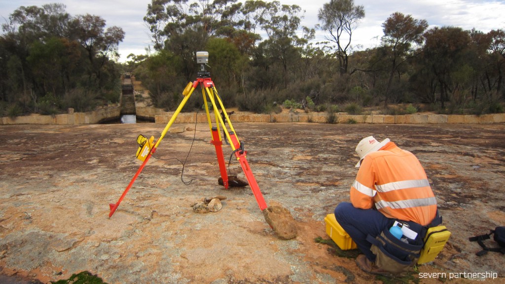
- 0.5 days was spent installing the geodetic control and referencing a local grid system. This included an overnight GNSS observation session and also Total Station measurements to coordinate the laser scanning control.
- The RTK survey was undertaken to measure the location of the earth’s dam wall and also parts of the rock. The results from this, provided the location of the rock water catchment wall and also contours on the rock.
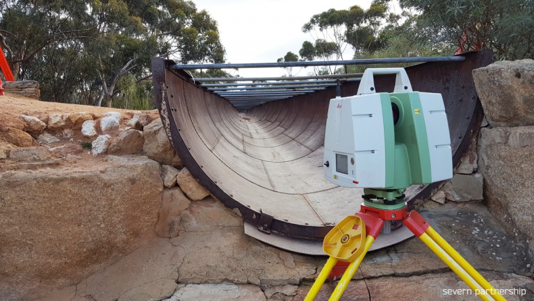
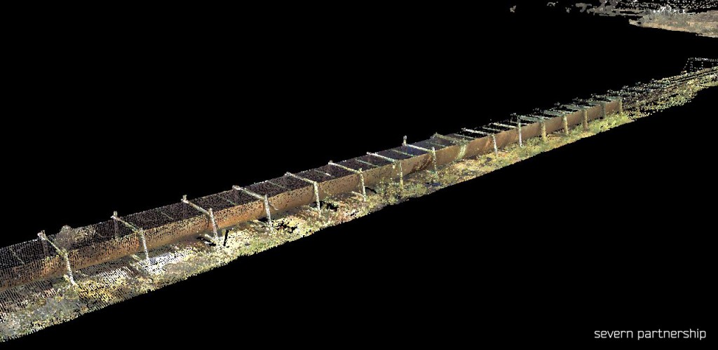
- Utilising the Leica C10 and P20 scanners, the task of scanning was undertaken in one day with two crews working for the full day. This created a thorough point cloud as the colourised images show. The scanners worked down one side each of the 180m steel flume. This was captured together with the dam and also the rock entrance to the flume.
- Comparisons will be made between original plans and the structure in place some 120 years after construction.
Benefits:
- Working alongside industry leaders and socialising with fellow students.
- Working with lecturers in a less formal environment
- Exposure to a wide variety of historic projects
- Gaining experience working in remote areas
Deliverables:
- Colourised point cloud
- RTK topographic survey of the structure and surrounding infrastructure
- Design drawings of the steel flume with weak areas highlighted
- Final project ‘thesis’ report and presentation at the completion of semester (November).
Severn Partnership capability to survey worldwide