Geospatial Consultancy – Mind the knowledge gap.
When procuring Geospatial surveys, it may be a simple task of sending out a standard, trusted specification, or relying on two or three quotes from trusted suppliers. That used to serve well in times past, but in todays fast paced world, a little knowledge is a dangerous thing. Surveying technology & workflows have advanced so quickly that projects that took weeks in the field two years ago can be done in a day without setting up a tripod. 300 survey points a day in 1990 is now 2,000,000 points per second.
“If you define the problem correctly, you almost have the solution.” Steve Jobs
Severn Partnership Directors and Project managers can provide expert geospatial consultancy in advance of large or complexed survey projects to ensure projects are set up to succeed from day one. Advising the right technology to use, expectations of programme, accuracy to match design needs and pitfalls to look out for. Our Chartered status with the RICS (Royal Institute of Chartered Surveyors) means we operate to a code of Ethics that dictates we act in the best interests of our clients, at the expense of additional work for ourselves – for you, that means a trusted partner, for us that means gaining trust and winning repeat work.
We also promote a culture of continuous innovation supported through active collaboration with external specialists and agencies and through investment in our quality systems. Investors in People accreditation, ongoing training and personal development initiatives are in place for all members of our team.

For a successful survey project, the key stages need to be well planned and the right survey tools for the job selected to hit the right balance of accuracy, detail, feature coding, plan or model deliverable and the options to add value by leveraging the data for other project teams like safety managers.
‘’There is nothing so useless as doing efficiently that which should not be done at all’’ – Peter Drucker
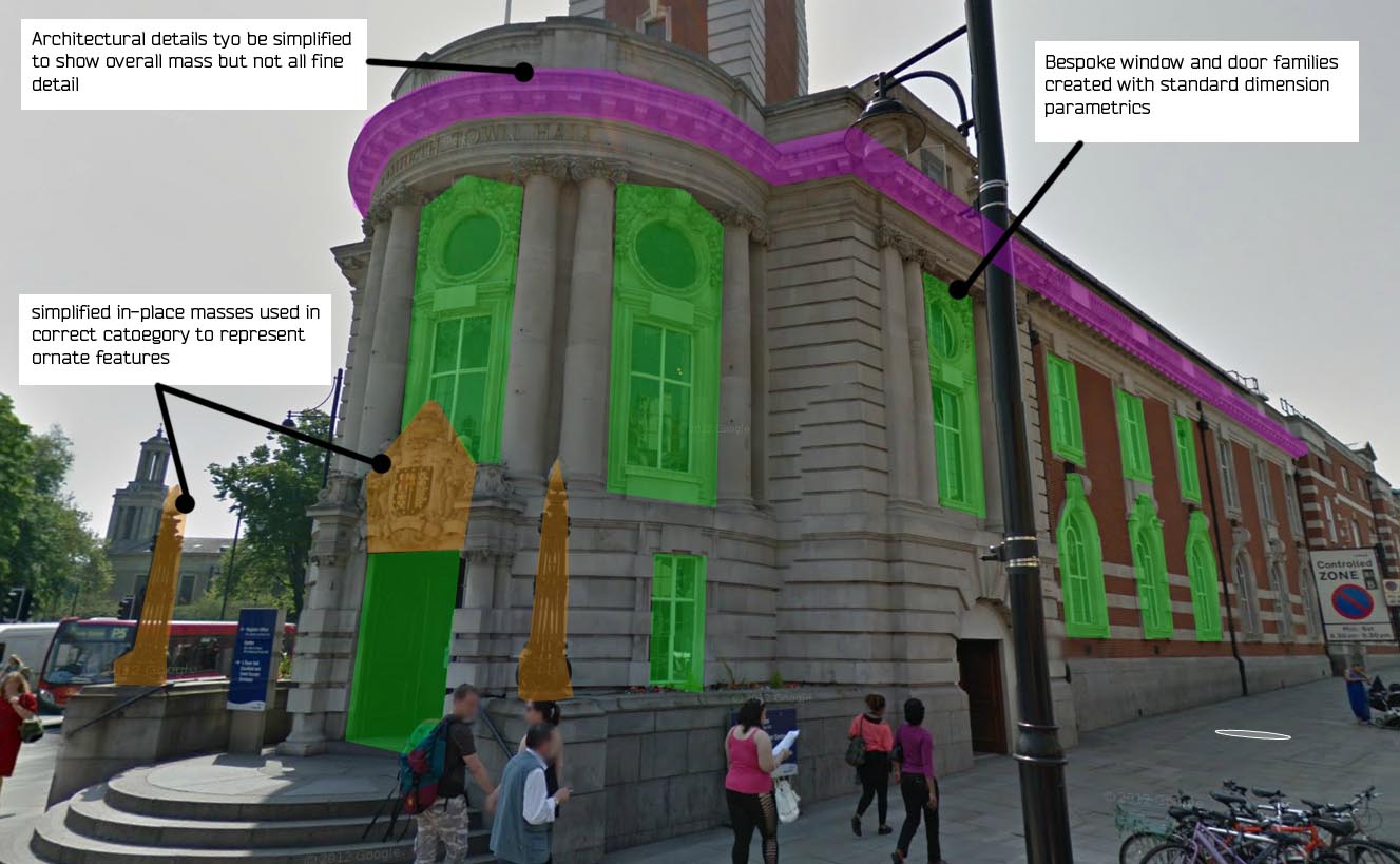
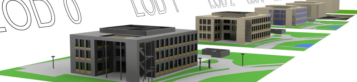
Niche sector knowledge can save time on site surveying details that are not required and make time to concentrate on what’s important to the project. This is increasingly important when procuring 3D datasets like Building Information Models or Digital Twin ready models. This is where we can use our BIM execution plan to talk through attribution of models and get to grips with LOD (level of detail) that agrees in advance how 3D modelling teams can generalise or simplify 3D objects.
We also recognise that to maximise our contribution to any project will need to work effectively as part of a wider team, including architects, consulting engineers, planners and project managers. Our commitment to partnership working means that our advice can often help our partners win more business by making their bids more competitive. When specifying the survey, it also implies taking into account the needs of other contractors who would benefit given the right survey brief.
“If you don’t have time to do it right you must have time to do it over” Russian Proverb
Consultancy may include:
- Defining survey specifications
- Planning Geodetic Snakegrids
- Coordinating project team activities
- Providing on site survey teams to undertake quality checks
- Office based data comparisons such as volume computations
- Proving surveys
- Acting as the ‘in house’ survey department for consulting engineers
- Advising on Visualisation deliverables to leverage value (Augmented Reality, Virtual Reality, 360 tours)