BIM4Rail – Crossrail London Railway Stations
Summary
Laser scanning of three London Railway Stations to create a BIM, allowing the re-design to take place for new Crossrail plans.
Background
Crossrail Limited, established in 2001, is the company that has been set up to build the new railway that will become known as the Elizabeth line when it opens through central London in 2018. Crossrail is pioneering the use of Building Information Modelling in Europe on a scale that has not been undertaken before. This has directly enabled us to develop innovative engineering design solutions, minimise waste and reduce future costs for maintaining the railway.’ – Crossrail.
In 2014 Severn Partnership were commissioned by Hochtief to undertake laser scan surveys of three London stations. The surveys took 3 weeks; one week per station, capturing up to 500 RGB static scans.
These stations are situated on the proposed Crossrail route & therefore are due to undergo substantial refurbishment.
Project Details
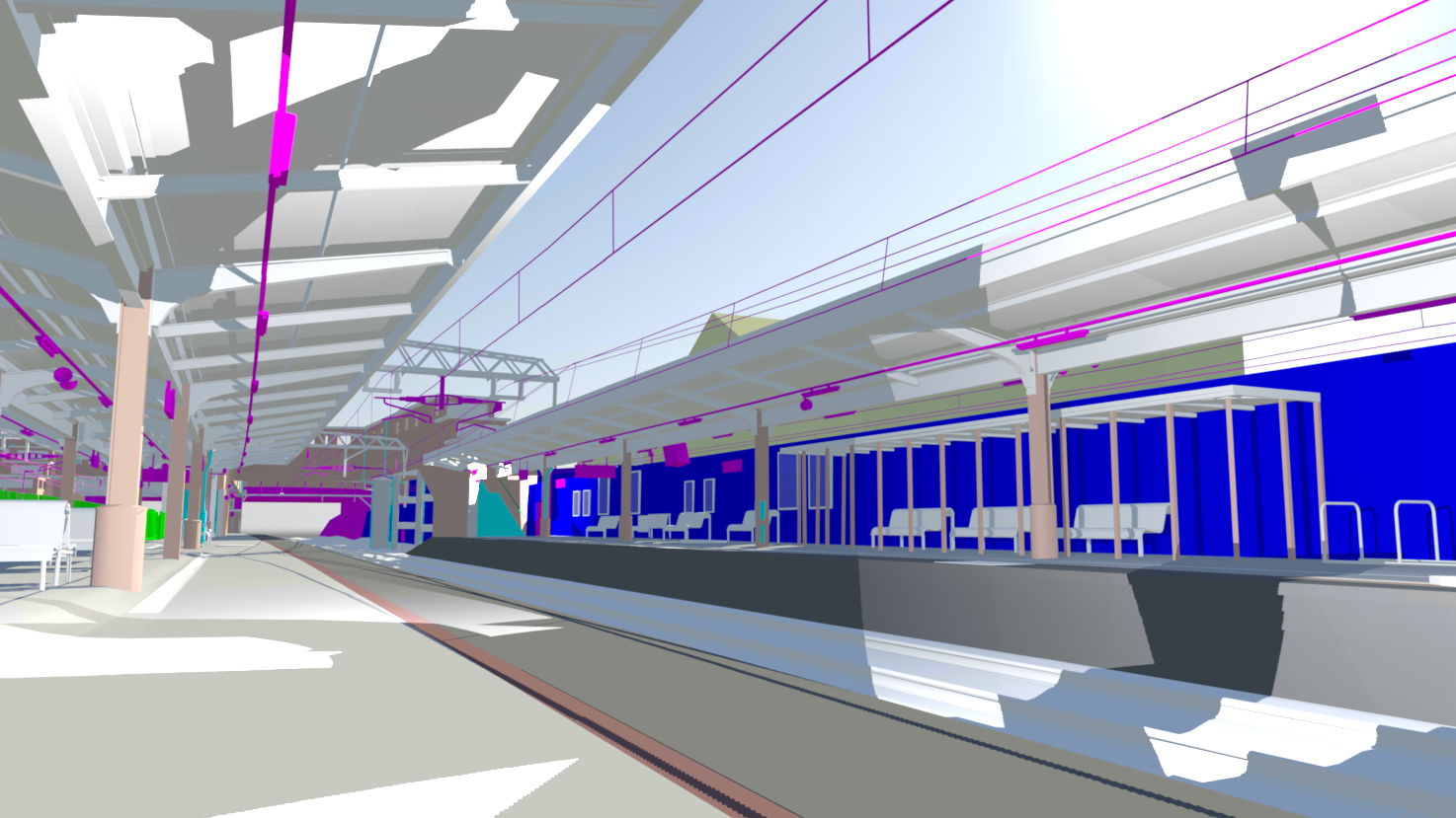
In 2016 many discussions took place between Severn & the design team with regards to the creation of a 3D model of each station. It was important that each model was suitable for each profession in terms of the level of detail and information included. For example, the Architect required LOD4 throughout all platforms capturing changes of surfaces such as drainage routes, concrete & tactile paving.
The model included all visible elements; platform furniture (seating, screens), tracks, sleepers, gantries, canopies, OLE, lighting and topography, as well as the main station buildings internally.
Each model needed to be created to within +/- 10mm. This lead to the decision to create the models within AutoCAD and export to the necessary DGN file format, to then be used within Bentley Microstation. CAD offered flexible modelling, allowing tight tolerances to be met for features such as the OLE. All components were categorised into the required and compliant Network Rail layering system. This was necessary to allow models to be segregated and federated between all stakeholders throughout GRIP design stages.
There are many challenges that come as a consequence from exporting to DGN (commonly loss of data). Our modelling team have processes in place to mitigate these risks. For example using the most up-to-date plug-in software exporting options, carrying out 3D visual checks and ensuring layering and entities are consistent between the two software packages.
The design team have utilised other deliverables such as Seeable Maps and TruViews, which are often agreed to be delivered as a package alongside 3D models. 360 Panoramic Images are taken on site in specified locations. Those images are then embedded within a 2D site plan or 3D model. Seeable Maps increase stakeholder understanding and allow visibility, ultimately reducing the need for on-site inspections. TruViews are a similar application which allow the user to ‘walk-through’ the point cloud. TruViews are hosted online for free, allowing anyone involved within the project to easily view and measure from the point cloud (using the various tools available). These tools have been made especially appropriate for those who have software restrictions.
All Severn Partnership surveyors are appropriately trained for working within the railway environment; with a dedicated HSQE performing site audits and completing necessary documentation.
Project Workflow
Exchange of Specifications / EIRS.
Initial meeting prior to quotation stage.
Quote / Pre-Tender BEP supplied.
Instruction.
Site survey.
Office processing.
Provide templates (SEED / layering system).
Work in progress quality assurance procedures.
Submission of models as per the agreement (i.e staged if necessary).
Work in progress meeting with the design team to ensure any issues are mitigated.
Handover.
Model maintenance & adaption.