What is BIM for Infrastructure (BIM4I)?
Building Information Modelling is usually associated with Architectural projects, although as the Infrastructure BIM Taskgroup points out, “BIM” is just an acronym for a collaborative way of working on design and construction projects.
The Government announced intention to require collaborative 3D BIM (with all project and asset information, documentation and data being electronic) on its projects by 2016. This includes road and rail projects. Severn Partnership is ideally placed as early adopters of laser scanning workflows, with 20+ years of specialism in rail / Pway survey and a specialist team of Building Information Modellers working across a number of BIM platforms.
The creation of Infrastructure Building Information Models is not just ’3D modelling’. Most BIM surveys start with 3D asset data collection (laser scanning) and involves detailed collaboration with clients to agree a project specification or once provided with employers information requirements, Severn Partnership will respond with a pre-tender BIM execution plan, detailing the specified level of detail to be achieved, including the methodology we propose to create and coordinate the model. The model will be coordinated, created and stored. This will also highlight what level of additional attribute information or parametric links the BIM ready model will require.
It is a special interest group within the Associate of Geographic Information (AGI), which is supported by the Institute of Engineers (ICE), the Government BIM Task Group and the Construction Project (CPI) Committee.
The group provides a forum for BIM professionals, such as Severn Partnership, to collaborate and provide leadership in establishing how infrastructure and buildings can be integrated and how BIM and Geospatial can interface and converge.
Case study – USK Viaduct:
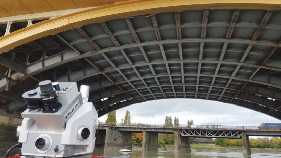
Severn Partnership have been involved with the Great Western Electrification Project (now Route Modernisation) since 2009. Whilst the top deck was surveyed using traditional static laser scanning techniques, the underside posed significant access challenges.
The Usk River has the second largest tidal range in the world, second only to the Bay of Fundy in Canada, and is the deepest river in the British Isles at its mouth. Severn Partnership utilised their Leica Pegasus:Two Mobile Mapping system, completing the work in a single daytime shift, from the safe confines of a boat and without any additional track access. Using existing static scan as control, both datasets were merged to an overall accuracy of +/-10mm ready for modelling in Revit.
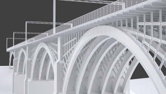
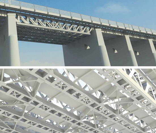
As part of Route Section 8 enabling works, a full 3D Revit Model of the Usk Viaduct was required to assess construction and strength for overhead line gantry positions. In order to translate the final registered point cloud into the desired BIM format, the data is passed from the Mobile Mapping Department to the Scan2BIM team who specialise in creating 3D models within Autodesk Revit. The model is made up of bespoke families, due to the age of the structure and complex structural elements.
In order to make a model intelligent, we are able to add attribute data to each component, this allows structural assessments to be easily made with regards to construction verification, stability and condition. Having a visual 3D dimensionally correct representation of a structure encourages collaboration and stakeholder understanding, increasing productivity of workflows, and ultimately leads to a successful project.
Deliverables:
- 3D laser scan, using a mixture of both static scanning and Severn Partnership’s Pegasus:Two mobile mapping unit
- Intelligent 3D Revit model