Project Summary
Severn Partnership were approached by Mott MacDonald Limited to conduct a comprehensive topographic and PAS 128 utility survey within Newport city centre.
Following a public consultation and feedback received from the public, the survey was required to help develop design proposals for improving the experience of travelling through Newport Railway Station, Old Green and the Riverfront.
Severn Partnership undertook three types of surveys: a topographic survey to map structures and ground surfaces in detail, a PAS 128 utility survey to identify and map buried utilities, and a drainage CCTV survey to investigate drainage systems and provide crucial data for the project.
A key focus of the topographic survey was to accurately capture structural elements around the Old Green Interchange, including bridge decks, retaining walls, pedestrian underpasses, and supporting columns. Additionally, underground services and drainage networks were mapped using non-intrusive techniques to provide a comprehensive dataset for the project’s future development.
The Challenges
Working in a busy city centre like Newport presented several challenges. The project needed to be carried out with minimal disruption to the public and local businesses while capturing vast amounts of above and below ground data efficiently.
Safety was paramount, with the need to protect both site personnel and the public, particularly given the high-traffic nature of Newport, the third-largest city in Wales.



Our Solutions
Severn Partnership tackled these challenges through careful planning, advanced technology, and a collaborative approach with stakeholders.
To ensure efficiency, we worked closely with Mott MacDonald and local authorities to develop an optimised survey programme. The topographic survey was completed over an eight-week period, with three weeks on site, while the PAS 128 utility and drainage CCTV surveys took ten weeks, with eight weeks on site. By deploying multiple teams working in shifts, site work and office processing were conducted simultaneously to speed-up data delivery.
Utilising cutting-edge technology was key to the project’s success. The Leica Pegasus Two:Ultimate mobile mapping system, combined with static laser scanners, captured a full point cloud dataset of the site. This approach reduced site time by up to 70%, eliminating the need for traffic management, and significantly improving safety.
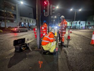
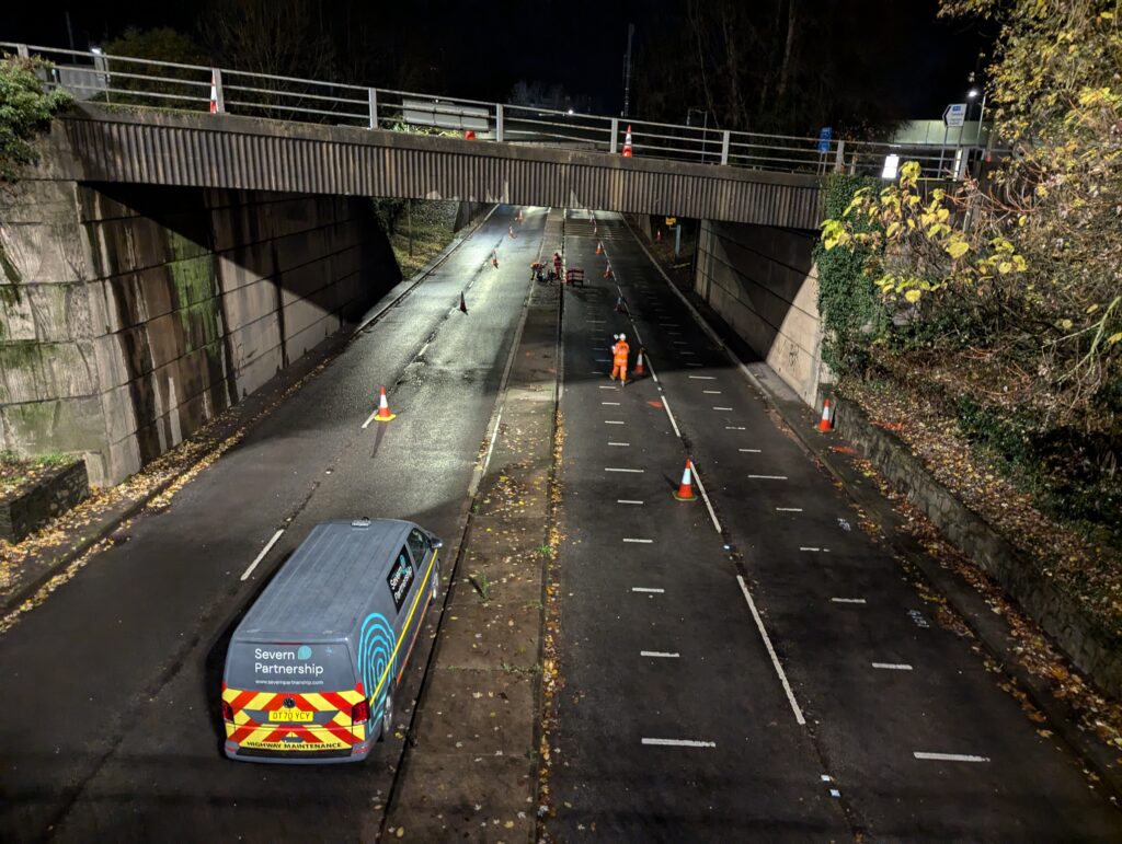
For the PAS 128 and drainage CCTV surveys, traffic management was necessary for accessing underground chambers and tracing service routes. Severn Partnership collaborated with trusted suppliers and local authorities to implement a phased traffic management plan, working at night and during weekends to minimise disruption.
Additionally, the use of the IDS GeoRadar Stream UP mobile GPR system allowed for highway data collection without requiring full traffic management, cutting the overall programme for site works by approximately two weeks. By combining the Leica Pegasus Two:Ultimate and IDS GeoRadar Stream UP systems, Severn Partnership delivered a highly accurate and detailed dataset in record time while maintaining safety and quality standards.
The overall project spanned three months, with the topographic survey completed first to allow for better planning of the PAS 128 and CCTV survey works.
Results
Severn Partnership provided Mott MacDonald with a full suite of deliverables, including a survey control report and witness diagrams, 3D topographic survey files, colourised point cloud data, 3D PAS 128 utility detection plans, manhole inspection cards, PAS 128 survey reports, drainage CCTV reports, and daily site shift reports.
The point cloud dataset provided an accurate, interactive 3D representation of the site, allowing designers to extract information without requiring further site visits, saving both time and costs while ensuring accuracy.
High levels of communication between a designated Severn Partnership project manager and Mott MacDonald, including weekly progress meetings and daily shift reports, ensured seamless execution and a highly successful project outcome.
By leveraging advanced surveying techniques, Severn Partnership significantly reduced the time required to collect and process data. The project achieved high levels of accuracy while ensuring minimal disruption and maximum safety. The use of mobile mapping technology meant fewer boots on the ground, improving safety for both surveyors and the public.
Connor Davis, Project Manager at Severn Partnership, reflected on the project’s results:
“The project was a great success, with a large-scale topographic and utility survey delivered in a short timeframe. The challenges were overcome through strong communication between senior surveyors, local authorities, and the innovative use of mobile mapping technology.”
Rhys Evans, Civil Engineer at Mott MacDonald, further highlights:
“We are working with the local authority to use the feedback received during the public consultation to further develop the proposals for Old Green roundabout. As part of the design development there was a requirement to undertake a topographic survey and PAS 128 survey.
“Severn Partnership were the successful tenderer for the scheme demonstrating a great understanding of the requirements needed via their tender submission and provided competitive costings.
“On-site, Severn Partnership competently managed the complex nature of the surveys while also managing the health and safety requirements for working in a busy urban highway environment, providing excellent collaboration with their Traffic Management subcontractor. In doing this they were able to complete all of the survey requirements within the agreed programme.
“Following receipt of the data, Severn Partnership were always available to assist in the refining and finalisation of the completed combined topographic/PAS 128 model.”
What does this mean for future projects?
This project has strengthened our relationship with Mott MacDonald, showcasing our ability to deliver large-scale, high-precision surveys efficiently. Our combination of cutting-edge technology, strategic planning, and collaboration continues to revolutionise how complex urban surveys are conducted.
Want to discuss this technology for your next project?
Get in touch with our mobile mapping Project Manager, Connor Davis, or connect with him on LinkedIn to find out how we can support.