Mobile Mapping Spaghetti Junction Survey Summary:
In March 2016, Severn Partnership surveyed Spaghetti junction using the latest mobile mapping technology in the form of the Leica Pegasus:Two. The deliverable consisted of a 3D laser scan model of the many junctions and road networks that are incorporated within the site. Surveying of UK roads and rail by traditional survey methods has been a core activity of Severn Partnership work for many years however the new technology enables quick, accurate data collection in comparison to traditional survey methods. The total dense road network was surveyed and mapped in just one day.
Project Overview:
The mobile mapping survey retained +/-20mm absolute accuracy . The system not only collects laser scan information but also includes high resolution calibrated Imagery to capture a complete dataset. The system also incorporates 360 degree view with the use of 8 cameras including a pavement camera to map the quality of the road surface. The mapping system allows the surveyors to collect data immediately with no road closures. Safety and quality measures were retained whilst obtaining an impressive 3D true colour point cloud of the whole road network.
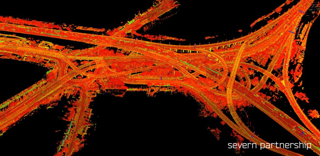
The mobile mapping technology allows the collection of 3DGeospatial data from a moving vehicle platform. The system incorporates an inertial measurement unit with a high quality laser scanner and GPS to generate a smooth vehicle trajectory. Furthermore, a 3D laser scan point cloud and the calibrated imagery are then synchronised.
Benefits:
- Huge cost savings with no “Traffic Management” required because of zero footfall required on site
- 3D data can be supplied and re-projected onto various survey grids
- Extensive point clouds can be used to extract features for use in topographical survey drawings and CAD models
- Completed in 1 day whereas traditional methods would require multiple weeks on site after organising safety requirements and fundamental road closures
- The majority of work was transferred to office based processing therefore assisting with safety benefits and ensuring staff remain within a safe working environment
- Raw Data set can be re-used including GIS Asset Mapping, Road Surface Condition Assessment or Clearance Analysis
- Site imagery can be shared with the project team in a ‘street view’ style potentially reducing the need for site visits
- Reduced working hours
- Door to door hours are reduced dramatically, providing us with a safe work environment within the office
Why use Pegasus: Two
- The combination of high accuracy LiDAR with photogrammetry ultimately means there is enough information collected with one pass of data collection. Additional information can be obtained with additional passes with varying scanner angles, if required.
- Street scene and rights for lights mapping using photogrammetry.