Mobile Mapping Pegasus:Two – Mainline Survey Summary:
Severn Partnership have been involved in the Midland Mainline Line Speed Enhancement project since 2010, delivering over 100 miles of permanent survey control and subsequent P-Way Track Survey. In 2013 over 70 bridge structures and 3 mainline train stations were added as part of the Electrification Program. All surveys relating back to the original Snakegrid control installed by Severn Partnership in 2010.
Project Overview:
As part of the Line Speed Enhancement project significant alterations are planned for Market Harborough Station to remove a major kink in the through alignment. The project required 5 miles of the mainline surveying, consisting of high accuracy track alignment, structure gauging, drainage tracing and topographic cess detail.
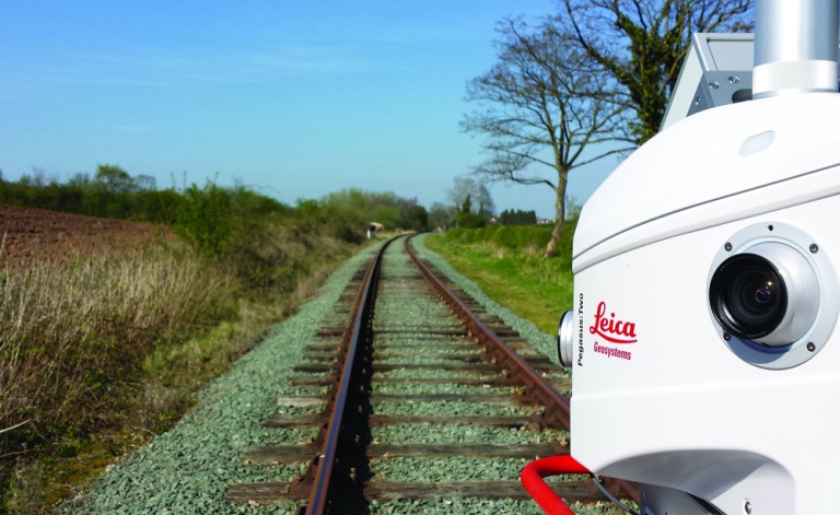
To reduce track access requirements the Pegasus:Two survey grade Mobile Mapping system was used to capture the topographic detail. Mounted on a motorised personnel carrier it captured a 3D Laser Scan Point Cloud and imagery at 10mph for the length of the site in a single 3 hour shift. The resulting data could then be digitised at the office without the time and safety pressures inherent with working on the railway network.
To maintain high accuracy the Point Cloud was linked to the site grid using the newly surveyed track alignment. The rails in the scan were automatically matched to the traditionally surveyed rail strings, resulting in sub 10mm accuracy relative to the track alignment.
Technical Services:
- Detailed Risk Assessment and Method Statement (RAMS) input into the Works Package Plan (WPP)
- Provision of PTS and COSS certified surveyors
- On track vehicle with POS and operator
- Local GNSS Reference Stations
- Dense 3D Laser Scan Point Cloud in LAS format
- Topographic cess detail CAD deliverables digitised
- Survey delivered on MML07 Snakegrid

Benefits:
- 1 team shift with the Pegasus:Two saved 20 team shifts surveying detail traditionally
- Fewer teams on the ground reduces risk to personnel and program
- All detail captured including cess detail, ballast profile, structures and vegetation, allowing for additional deliverables without the need to revisit site
- Site imagery can be shared with the project team in a ‘street view’ style potentially reducing the need for site visits