Underground utility mapping services
The detection and mapping of underground services include: pipes, cables, ducts and culverts using a range of utility survey techniques such as GPR, electro-magnetic location, manhole inspection and CCTV. The necessity for the accurate location of buried services and the intelligent presentation of results and reports has increased dramatically over the last decade. Legislation, health and safety, diversions, connectivity and the increasing complexity of utility networks, have all driven the requirement for underground utility mapping services.
Severn Partnership has developed its in-house utility detection capabilities in line with demand and now offer bespoke utility detection surveys and consultations to meet any client objective. Severn Partnership’s ability to offer a complete mapping service of above and below ground infrastructure, will offer clients multiple benefits that include cost savings, greater accuracy and a one point of contact for all your topographic and utility survey needs.
Our utility services include:
- Comprehensive utility detection surveys
- Mobile GPR
- On site ‘mark up’ surveys
- Drainage surveys
- Manhole inspection
- Compilation of existing utility provider statutory records
- Pipeline mapping
- Borehole and trial-pit utility clearance
- Topographic survey and laser scanning
Surveys are designed in accordance with PAS:128 guidelines.
Severn Partnership believe that the key to a successful detection survey is to fully understand the client’s underlying survey objectives. Severn Partnership can devise the most relevant and cost effective solution to fulfil your utility survey needs.
With our investment in the latest GPR technology, Severn Partnership can now implement a number of additional survey types that include; void detection, underground storage tank mapping, concrete floor scanning, structural surveys and the location of buried foundations/basements.
Severn Partnership is committed to developing new innovative ideas including how utility information is viewed and presented to clients. Using our 3D modelling and BIM capability, we now have the ability to visualise buried services in AR (Augmented Reality) with real-time location and orientation tracking via Trimble Site Vision; ask the team to find out more.
Mobile GPR Technology Innovation
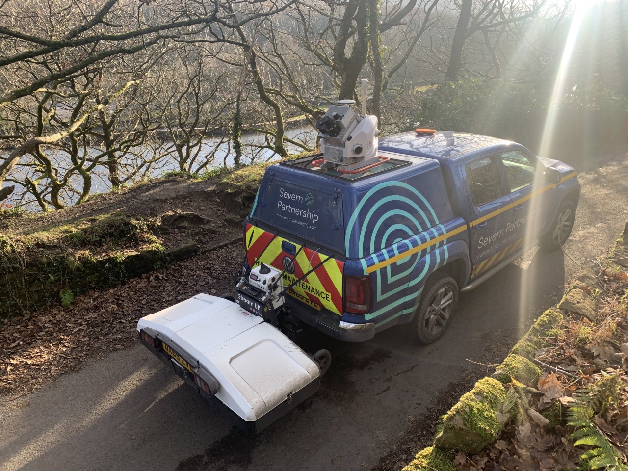
Severn Partnership have recently invested in the latest Mobile GPR technology, the IDS Stream UP. This equipment allows us to undertake GPR surveys at road-speed without the need for traffic management and subsequent costs to be passed on to our clients. Further value is passed on through improved safety, both for survey teams and the public.
We are able to work on highways, as well as surveying off-road and harder to reach locations, whilst maintaining the same accuracy in deliverables. This data can be complimented using our hand pushed GPR array, the Stream C. This gives a whole data set regardless of the environment.
Client Deliverables:
- 2D/3D CAD plans
- BIM
- Utility detection survey report
- Manhole/Drainage schedule
Confined Spaces Survey:
Confined spaces refer to an area where enclosed conditions and limited access make it dangerous. These surveys require breathing apparatus, a confined spaces kit, specialised training and emergency response teams, any access to these surveys will be restricted. We have experienced surveyors, trained to the current safety standards in order to work in these environments. Along with the specialist training, we are fully equipped for safe working, with intrinsically safe torches, breathing apparatus and gas detection devices.
Potential Confined Spaces Applications:
- Road or railway culverts
- Tunnels and shafts
- Building voids and cavities
Examples of Relevant Experience Include:
- River Ash culvert survey
- Graveney Siphon – Environment Agency
- River Hull service diversion